To become World Heritage Listed a site must meet at least one of ten cultural and natural Criteria for Selection as classified by UNESCO. There are over 1000 sites throughout the world now on the World Heritage List. Of these sites there are only two that have achieved seven of the ten criteria; Mount Tai in China (i, ii, iii, iv, v, vi, vii) and the Tasmanian Wilderness (iii, iv, vi, vii, viii, ix, x). The Tasmanian Wilderness World Heritage Area now takes in over 1.5 million hectares or around 20% of the island state. Seven of the 19 national parks in Tasmania form the vast majority of land designated and protected to World Heritage. Included in the area is Cradle Mountain – Lake St Clair National Park one of the most popular wilderness destinations, and the starting point for the internationally recognised Overland Track.
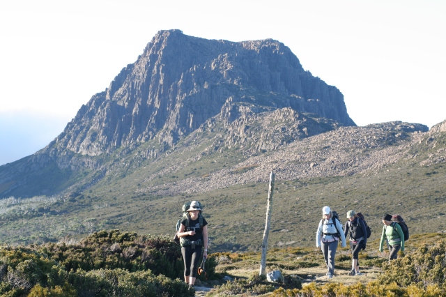
Cradle Mountain, the south face from the Overland Track
Both my wife and I grew up in Tasmania. When it came to recreation her family headed to the picturesque east-coast to their ‘shack’ for sun and surf while my family delved into the wilderness, camping alongside pristine waterways under ancient forests. Now, with our own kids, we have enjoyed plenty of beach time and day trips into some of Tasmania’s wild areas but I have stopped asking the question containing the words ‘tent’ and ‘camping’. The response has always been the very Australian phrase, “Yeah, nah.” So on my birthday earlier this year I was very surprised to be opening an envelope from my wife containing walking passes for the Overland Track! Just the two of us, on an adventure I had put off for far too long. Still no need for a tent though, we were doing this the comfortable way, guided with the Tasmanian Walking Company. Compromise is a wonderful thing.
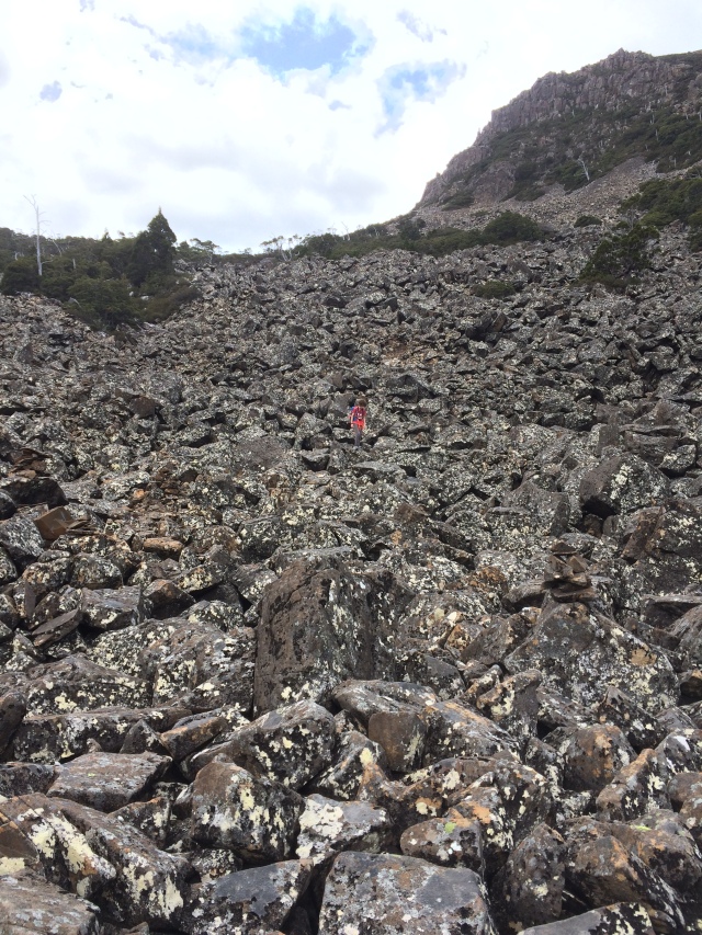
The Overland Track winds its way from the northern end of the Cradle Mountain – Lake St Clair National Park down to Lake St Clair itself at the south-eastern tip of the park. It is generally a six day walk and offers several side trips with varying degrees of difficulty along the way. It is arguably the best way to experience a small glimpse of the incredible beauty the Tasmanian Wilderness World Heritage Area offers. In ideal conditions this is by no means a challenging walk, about 65-80 kilometres, for the reasonably fit bushwalker. Five or six days of ideal conditions is a rare occurrence though in the highlands of Tasmania. Our peaks rarely jut above 1500 metres, only a dozen or so can claim that honour. The catch is, the only thing south of Tasmania is Antarctica and when the weather comes from the south the conditions can very quickly turn brutal. Walking into the Tasmanian wilderness unprepared is a perilous activity which has lead to disastrous outcomes.
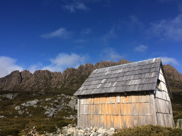
Kitchen Hut & Cradle Mountain
Day 1. – We met at the headquarters of the Tasmanian Walking Company, greeted by our two guides and five others embarking on the walk with us. The first task is laying out all your clothing for appraisal. Will your garments hold up in case those brutal conditions decide to descend? Thermal base layers, waterproofs and jumpers are all scrutinised, then you pack your gear into supplied backpacks and set off on the two hour bus journey to the start of the track. The journey begins from Waldheim hut, first built in 1912 by Gustav and Kate Weindorfer, it was completely rebuilt in 1976 using the traditional building methods and timber as the original. Gustav Weindorfer was one of the first Europeans to recognise the importance and unspoilt nature of the area, and was instrumental in its early protection. Marion’s Lookout was our first stop after a short steep ascent past Crater Lake. With the advantage of clear skies and warm sun the view was spectacular, Dove Lake below and the rugged Cradle Mountain (1545m) rising up alongside. We skirted around Cradle Mountain, stopping for lunch outside the historic Kitchen Hut, and onward in the direction of Barn Bluff (1559m). An impressive dolerite monument, it stands alone surrounded by open plains and ancient glacier carved valleys. Our destination was Barn Bluff Hut hidden away deep in Waterfall Valley under the shadow of its namesake. We arrived late in the afternoon still exhilarated from all that we had seen throughout the day. I had no idea what to expect of the huts and their facilities, and I will not describe them further, other than to say any chance of a tent holiday has now been completely eroded.

Cradle Mountain

Waldheim

Barn Bluff
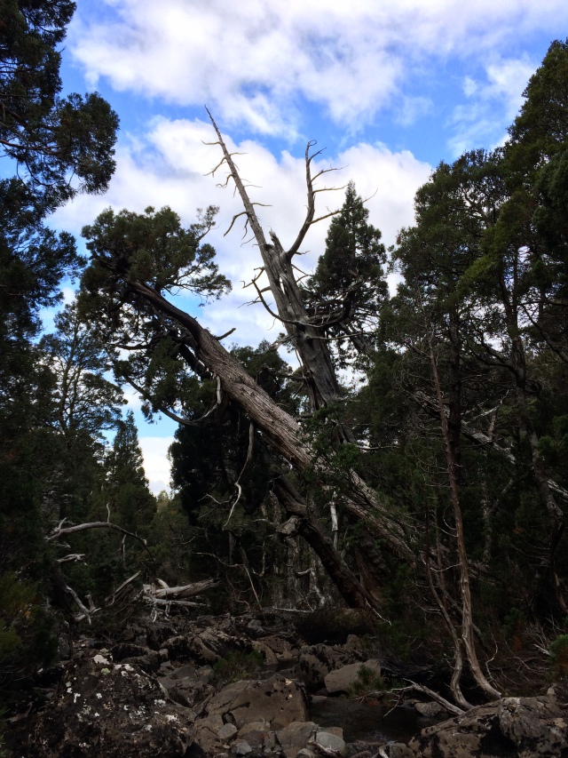
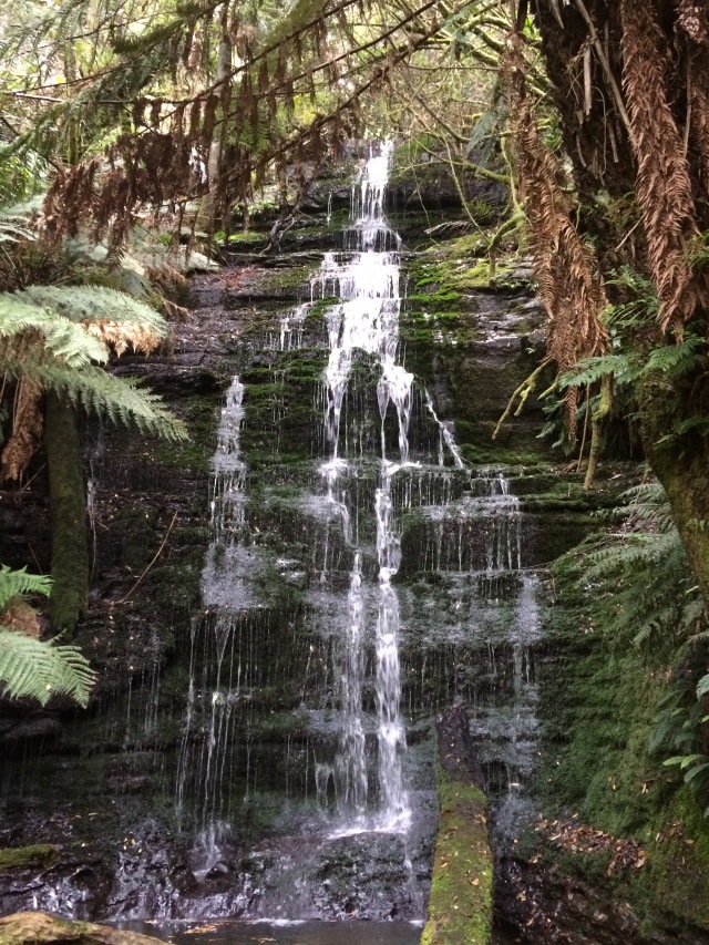
Day 2. – Steady rain on the roof woke us from our slumber. It was going to be one of those days. We prepared ourselves to face the elements and set off. Lake Will, named after an early mining prospector Joseph Will, was to be our first destination for the day. Our guide described it as a beautiful summer side trip as the lake has golden sandy edges perfect for beach-like sun bathing. But it was autumn, rain was still falling and winds were gusting, enough to nearly blow us off the boardwalk. (Significant amounts of the track are now on boardwalk, particularly over the button grass plains, to reduce environmental impact and the quagmire that can set in after heavy rainfall.) The option was offered to forgo the side trip but we were a resilient group, and happy to drop our packs for the side journey of about an hour return. Before the Weindorfers came to Cradle Mountain for recreation many had come before them to seek their fortune. The track into Lake Will wanders past mullock heaps long ago abandoned but still plainly visible from unsuccessful coal exploration. It’s a sign of just how long regeneration can take when 120 years later the scars are still visible. Fortunately the remote environment, grim conditions, and tools limited to pick and shovel prevented major upheaval. No doubt on a fine day Lake Will would be a stunning stop off. It wasn’t in our favour that day so we didn’t linger. We returned to our packs and made our way to Windermere Hut for lunch. No amount of wet weather gear can keep you dry in these conditions. Boots and socks were sodden and base layers too were being challenged by the penetrating rain. A hot cup of tea all but briefly revitalised the senses. We were keen to set off again, walking to get ones body heat increasing was the best barrier to the dismal conditions. Views were diminished over the plains throughout the afternoon. Long before European encroachment the plains were utilised, at least seasonally, by the Big River Nation group of Aboriginal people. Fire was used on the plains as a tool for hunting, to flush out quarry. Written records from early contact cite bark huts and burnt countryside in and around what is now national park. The reality of that contact is, in not more than 70 years, the original inhabitants and their many thousand year old culture was to be decimated across the entire state. Even the original languages have mostly been lost. In recent years, through much research and analysis of historical recordings, a revived form of language known as palawa kani has been brought to life. The process of recognising notable places by dual names is now under way in Tasmania (lutruwita). We passed beyond the plains to eventually set foot in an enchanting myrtle and beech forest. The inclination was to pace forward, to get the day over and done but every step of the way something in the forest caught the eye, lichens, fungi, or a gnarled old tree trunk. It was a captivating end to a very dreary day.

Early afternoon, entering the ‘enchanted forest’

Setting off to Lake Will

Lake Will
Day 3 – Setting off into snow has you bounding out the door with childlike enthusiasm. Overnight a few centimetres had fallen and throughout the morning flakes continued to settle. There were fleeting glimpses of snow capped peaks as heavy clouds were briefly split open by shards of sunshine. Autumn is the time for fungi to emerge in all its variety and incredible colours. Traipsing through dense old growth forest little caps proliferated from each and every long ago fallen log. Others pushed up through the earth to stand alone, oblivious to their extraordinariness. We descended gently down to the Forth River, one of the lowest sections of the Overland Track. Snow melt had already begun to swell its course. Fortunately there is a sturdy bridge to enable you across, although our guide told of a time he had to traverse in knee deep water, the bridge submerged and the elevated handrail the only indication of its existence. There is a steady ascent out of the valley and onto the Pelion Plains. Mt Oakleigh was ever present alongside us with its jagged outcrop of stone spires. Our stopping point was Old Pelion Hut another relic from an era when exploratory mining of the area was a rational notion. The hut survives 100 years on, originally used as accommodation for miners, it also housed graziers, trappers and surveyors to the area. It’s hard to fathom how such a remote and inhospitable area entertained people with the idea to scratch out a living. A short distance from the hut, and this still confounds me, I was guided into the disused copper mine left behind by some of those early pioneers. It is hand carved horizontally for about 50 metres into a rock face, well out of sight of the main track, it is now a home for crickets, spiders, and even a small bird had built a nest just inside the entrance. It wasn’t worth imagining a plundered landscape had substantial deposits ever been unearthed. Back on the track you’re very quickly engulfed again by the magnificence of the place and the level of determination Gustav Weindorfer must have had to see it protected in a time of flourishing industrialisation. Another day drew to a close with the track revealing a history I had no idea ever existed.

Setting off on Day 3

Mount Oakleigh

Cave cricket

Exiting the copper mine
Day 4 – Snow had again fallen during the night. Our excitement for it was no less than the previous day. (And yes, a few snow balls may have been thrown!) Unfortunately the snow meant the day’s major side trip, climbing Tasmania’s highest peak Mt Ossa (1617m), would not go ahead. We were headed in the direction of Pelion Gap, the divide between Mt Pelion East (1461m) and Mt Ossa. A short detour was taken to see Douglas Creek, at a picturesque spot known as The Cascades, where the waterway spills over a gently sloping dolerite formation. We continued on into dense rainforest. Tasmania has several native conifers amidst our forests and three that are particularly noteworthy for The Overland Track. The King Billy Pine (Athrotaxis selaginoides) and Pencil Pine (Athrotaxis cupressoides) are scattered throughout the National Park. One of the reasons for the longevity of many of the old huts along the track are the fact they are made from King Billy Pine. It is renowned for its durability. The timber is incredibly tight grained due to its very slow growth rate and is highly prized for boat building. While the Pencil Pine is a very close relative of the King Billy its timber has not been so highly regarded by craftspeople. Nevertheless both species have suffered great losses over the years from wildfires throughout the state’s wilderness areas. The third, and extremely rare conifer, is a naturally occurring hybrid of the King Billy and Pencil Pine known by its Latin name Athrotaxis X laxifolia. It was under an impressive 600-800 year old example that we stopped for our first break of the day. The growth rate of these magnificent conifers rarely exceeds about one millimetre a year! We moved on and up toward Pelion Gap leaving the forest behind us. While the summit of Mt Ossa was off limits we ascended to the saddle between Mt Ossa and Mt Doris (1340m), an area known as the Japanese Gardens. The snow was heavy on the ground and the air crisp but the conditions were pleasant enough to enjoy lunch. Mt Pelion East emerged from the clouds and the vertical cliff face of Cathedral Mountain (1406m) could be seen in the distance. Our day’s journey would finish at the foot of the spectacular cliffs. Only the hardiest of plants survive in these conditions. One of those is the deciduous beech (Nothofagus gunnii), most often simply called fagus. It goes unnoticed for most of the year except in autumn when, being Tasmania’s only native deciduous tree, it puts on a show. With the ground blanketed in white and the evergreens stoically retaining their foliage, the golden hue of the fagus is a sight to behold. The more adventurous bushwalkers know it as tanglefoot for self explanatory reasons. We arrived at our hut in the early afternoon. The rest of the day was spent relaxing taking in the view of Cathedral Mountain watching the clouds whirl around its sheer cliff face.

No need for a fridge, leave the wine outside to chill

Japanese Gardens

Bennets wallaby

Athrotaxis X laxifolia, the naturally occurring King Billy & Pencil Pine hybrid

Deciduous beech ‘Fagus’ Nothofagus gunnii

Mount Pellion East
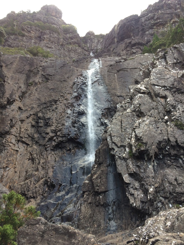
Day 5 – Although only a short day of walking was planned it was to become a full day because of the stunning terrain we were venturing through. Within the first hour we had arrived at Du Cane Hut. Another of the early huts on the track, built about 1910, this one was constructed by a revered bushman Paddy Hartnett. While Paddy was an accomplished trapper and sometimes prospector our guides acknowledged him most highly as the original guide. He was one of the first to accompany visitors into the wilderness and was instrumental in cutting the track through to Lake St Clair. We departed individually from Du Cane Hut at intervals of about twenty minutes. It was an opportunity for some solitude under the canopy of the imposing forest around us. We gathered again at the junction of our next side trip to D’alton and Fergusson Falls. Both falls are on the Mersey River and only a short distance from each other. There is some steep going but well worth the effort. D’alton falls offered the better view from a narrow outcrop directly opposite. The access to Fergusson Falls takes you in alongside the fall, adjacent to the precipice from where the water plummets. After the previous few days of snow and rain we were fortunate to see them surging. Seeing the Mersey not far from its origin was significant. As a child one of my camping destinations was alongside the very same river much further north in the Mole Creek Karst National Park. The next leg of the journey was slow going simply because of the ridiculous amount of captivating fungi on display. The colours, shapes and sizes on display were remarkable. We were wending our way around the Du Cane Range making for the Du Cane Gap with our accommodation a short hike over its crest. It was a gentle ascent that took us up out of the damp heavy forest into sclerophyll forest populated by eucalyptus, sheoak, banksia and the like. Alongside us was Castle Crag still tipped with snow. It is also known as Falling Mountain as its weather beaten dolerite cliffs are in a constant state of crumbling. This was our last evening in the Tasmanian Wilderness World Heritage Area, our adventure was almost accomplished. My pace had slowed over the last few kilometres, not from exhaustion, but a reluctance for the trek to be over.

Paddy Hartnett’s Du Cane Hut

D’Alton Falls

Fergusson Falls
This slideshow requires JavaScript.
Day 6 – The final day loomed before us. As a group we had journeyed well together. We had all found some common interests and spent moments along the track, and of an evening, sharing our life experiences. I imagine group dynamics are a significant factor for guides in undertakings such as these. At the very least our guides were happy none of us had boot failure of any kind! Apparently it’s one of the most common inconveniences, a boot or two simply falling apart en route. We were amply warned to keep boots well away from the heater in the drying room. Setting off in damp boots, still with their structural integrity, was the much preferred option of the guides. Our group included two from Queensland, two from NSW, one from Germany, and us, two Tasmanians. I would argue we were the luckiest of the group; we were remaining on this remarkable little island at the end of the trip. It was an easy morning of about three hours walking under clear skies. The walk for us came to a close at Narcissis Hut at the northern end of Lake St Clair. The Narcissis River feeds into the northern end of the lake and at the southern end the Derwent River begins its 200 kilometre stretch to Hobart. A small passenger boat picks up anyone not walking the lake’s perimeter, another 5.5 hours, to the Lake St Clair Park Centre. The comparison is always going to be there, taking on the Overland Track independently or guided. There is no doubt in my mind having guides on hand to impart their knowledge of the track was invaluable. I walked out with a far greater appreciation of the track’s history and importance to this state than when we set off. I would certainly like to retrace my footsteps unassisted some time. I can now do it with the knowledge the Overland Track is much more than an unforgettable wilderness experience. It is history, people, unique flora and fauna, human endeavour and tenacity. No wonder it ticks so many boxes for its place on the UNESCO World Heritage List.

The final few kilometres

Crossing the Narcissis River

The Idaclair, our ride across Lake St Clair
* * *
The Overland Track: for details and to book as an independent walker.
The Overland Track guided walks can be undertaken with Parks and Wildlife approved licensed operators: Tasmanian Walking Co., Tasmanian Wilderness Experiences, Tasmanian Expeditions, Tasmanian Hikes.
Many thanks to Nick and Lauren our guides. Their extensive knowledge was invaluable and piqued my curiosity to learn more…
Timothy Jetson – Almost a Walkers Paradise: A history of the Cradle Mt – Lake St Clair Scenic Reserve to May 1922 (Phd thesis School of History and Classics, University of Tasmania October 2005)
Timothy Jetson – ($4.00+GST) Journal of Australasian Mining History Volume 7 September 2009: ‘That Some Rich Lode Amongst These Hills is Waiting for us Yet’: Balancing Mining and Environmental Concerns in the Cradle Mountain – Lake St Clair National Park, Tasmania
Simon Cubit – Recording Paddy Hartnett’s Huts
Simon Cubit & Nic Haygarth – Mountain Men: Stories from the Tasmanian High Country
Department of Primary Industries, Parks, Water and Environment – Establishment Report for Tasmanian Wilderness World Heritage Area Climate Change Monitoring Program: Montane Conifers
Linc Tasmania – Photographs of Waldheim Chalet and Gustav Weindorfer 1920s – 30s
On the lookout for a King Billy Pine boat? The Australian Wooden Boat Festival is a biennial event in Hobart, next held February 8 – 11 2019.
For the completely crazy: Want to run The Overland Track? Cradle Mountain Run February 3, 2018. Entries open October 15, 2017. Current record is 7 hours 25 minutes!

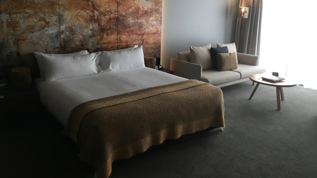
 Staying at MACq 01 was a little indulgence for the brief trip to Hobart. Having a range of dining and bar outlets on site enabled grazing and sipping options before and after the show. The late afternoon was spent outside at the Story Bar with a couple of Bruny Island beers and Forty Spotted Gin cocktails alongside snack food delivered from the kitchen and a seafood barbecue set up on the adjacent deck. I am not sure how often the barbecue operates but the tuna and barramundi dishes that came from it were excellent as were the three cheese arancini balls from the kitchen. The barbecue is a simple yet fabulous addition.
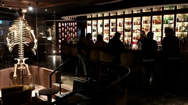
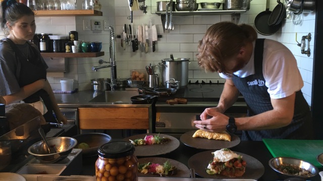
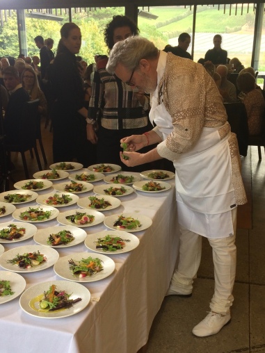 him…’ This would be the answer repeated consistently should you stop people in the streets of Launceston and ask them what they know about Alain Passard. It’s not a criticism, it’s knowing Launceston is a small city on a small island about as far from Europe as can possibly be. It’s knowing like many small regional Australian cities, sport is where our idols are sourced. TV shows like My Kitchen Rules are predominantly where our food interest lies, and that’s because it’s about personalities and elimination, cooking as sport if you like.
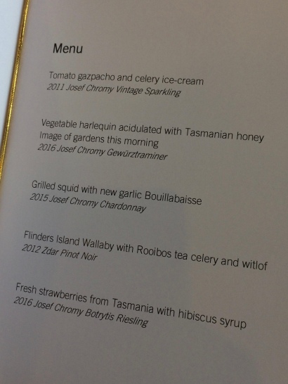 Lunch was five courses all superbly matched with Josef Chromy wines by head wine maker Jeremy Dineen. The second course deserves a mention for both its description, ‘Vegetable harlequin acidulated with Tasmanian honey, Image of gardens this morning,’ and Chef Passard’s exacting expectations the ingredients were all to be picked on the morning and not to see a refrigerator. It was a dish of exceptional colour, taste and textures paired perfectly with 2016 Josef Chromy Gewürztraminer. Each and every course offered a myriad of pleasing aromas and flavours.
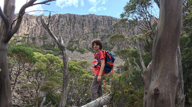
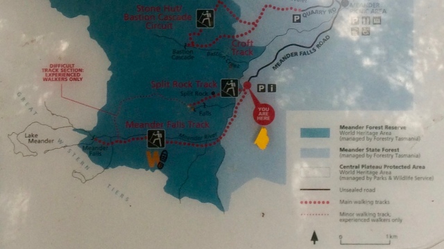
 As I mentioned earlier though, there is another route to Meander Falls, and I did put the idea in my son’s head to take that option. Whilst I was familiar with the track I had not attempted it before. It is known as the Split Rock track (Cleft Rock track on some maps), less often used, and significantly longer with stretches which demand both concentration and experience to navigate successfully. While the more direct Meander Falls track mostly follows the course of the Meander River, the Split Rock track immediately takes you across the river and plunges into steep, dense rainforest terrain. The sound of the river is left behind, markers are scarce, the path rarely trodden, and this is just the easier sections!


 The first section of the track is in part over an elevated boardwalk through paperbark swamp to a bird hide which looks out over the Spinglawn Lagoon. There are plenty of wading birds and ducks bobbing on the water. Keep an eye out skyward also, the
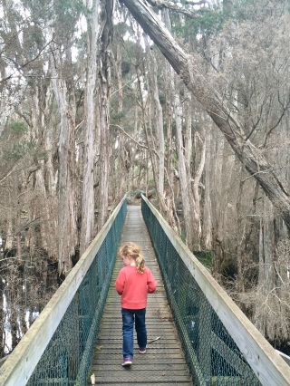
 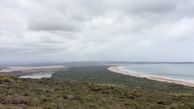 The view west back down to Springlawn Lagoon and Bakers Beach is most impressive from the summit while the view to the east, Little Badger Head and Badger Head, is best about halfway up. There are a couple of theories on the origin of the name Badger Head. The first is that wombats, which are in abundance in the national park, were often referred to as badgers by the British colonists hence the name. The other is the coastal features are named after
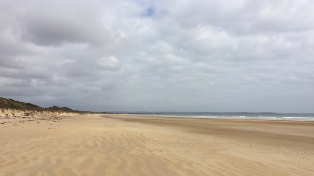
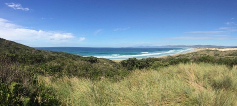
 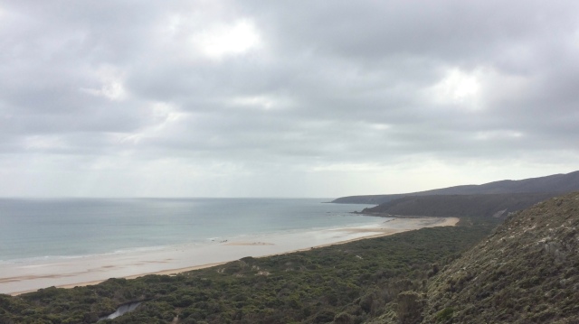 After lingering for a while taking in the view and a snack it was time to head back down the hill and make our way to the beach. The track to the beach seems longer than necessary until you realise it navigates around another smaller lagoon tucked in between the dunes. The tide retreats a long way out and the beach slopes away very gently leaving a vast space for any child, or adult, to explore. My daughter’s shoes and socks were quickly discarded and her pockets were immediately being filled with shells of all shapes and colours. The skeletal remains of a porcupine fish held her attention for quite some time and a shark’s egg was a great find. There was not another soul on the beach. This is not uncommon in Tasmania.


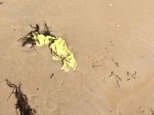 Pick up some flotsam…
 On the highway from Launceston you will not miss the signs encouraging you to head in the direction of
  There is only one small sign for the falls, spelt with an ‘e’, Westmoreland Falls, at a T-junction a kilometre or two before the carpark. At this point the road becomes unsealed and meanders through a cattle farm and past a side entrance, for experienced cavers, to the underground network that is
 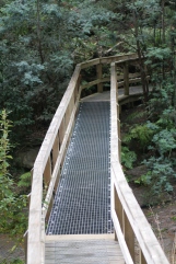 In January 2011 there was an unseasonal torrential downpour. The creeks burst their banks and the massive volume of water that tore through the area destroyed foot bridges and parts of the walking track. It was two years before a new path and bridge were reinstated. The one time along the track that the canopy opens up is when you cross the bridge. The hugely eroded waterway is slowly returning to its former self. The forest is once again edging its way closer to the stream thanks to the dogwood saplings keen to take advantage of the previously washed away banks.


 Most of the animal life within the forest, at the sound of human footsteps, swiftly disappear. Leeches are an exception. There are


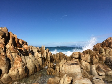


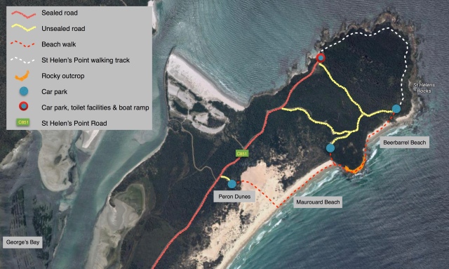
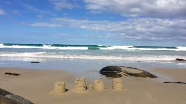 stopping to clamber up the rock the girls had climbed the day before. The descent down from the rocks onto Beerbarrel Beach is narrow but manageable. We found everyone at the far end of the beach and spent an idyllic afternoon building sandcastles for the tide to demolish, as it inched its way further up the sand, one wave at a time.